
Lago di Sorapis in Italy: The Bluest Lake in the Dolomites
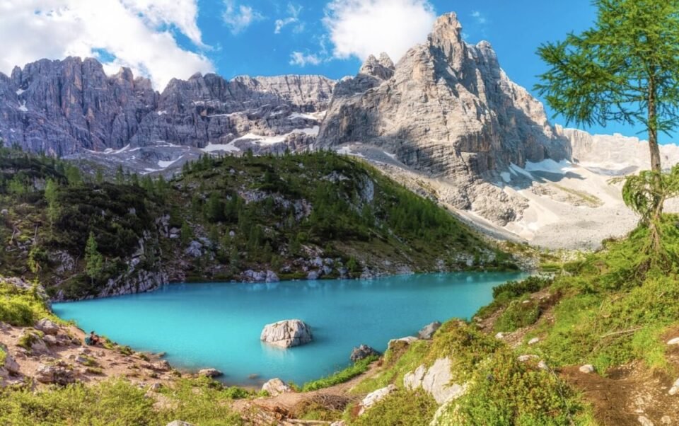
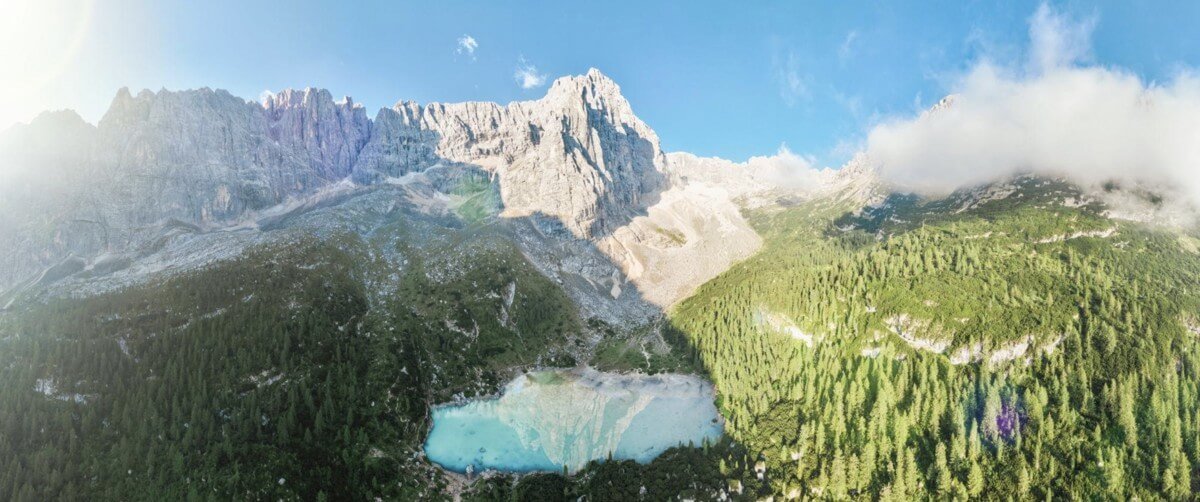
Lago di Sorapis (Lake Sorapis) is one of the most impressive mountain lakes in the Italian Dolomites. It is famous for its bright turquoise water, which looks almost unreal and is often compared to the color of tropical lagoons.
Unlike many other lakes in the Dolomites, you cannot drive here — you have to walk. That is exactly why Lake Sorapis remains a less accessible and more atmospheric place.
Below we take a detailed look at how to get to Lake Sorapis, which route to choose, and how difficult this trek really is.
Where Lake Sorapis is located
Lake Sorapis is located in the Italian Dolomites, not far from the resort of Cortina d’Ampezzo.
The nearest starting point:
- Tre Croci Pass
The lake’s elevation:
- about 1,925 meters above sea level
It is precisely this altitude and the mountain setting that create the typical alpine landscape around the lake: rocky peaks, steep slopes, and panoramic views that open up right from the shore.
The route to Lake Sorapis (Trail 215)
This is the most popular and relatively convenient route to the lake, and the one most tourists take.
The main thing to understand: despite its popularity, this is not a walk along a flat road, but a full-fledged mountain trek with elevation changes and sections that demand extra attention.
Main characteristics of the route
| Parameter | Value |
|---|---|
| Route | No. 215 |
| Route type | Out and back |
| Route length | ~10–11 km |
| Travel time | 2–3 hours one way |
| Elevation gain | ~400 m |
| Difficulty | Moderate |
| Route start | Tre Croci Pass |
Route description
The route starts at Tre Croci Pass and follows the well-marked Trail No. 215.
The first sections go through forest along a wide path, where walking is fairly easy. After that the route gradually becomes more mountainous: rocks appear, along with narrow sections and open views over the valleys.
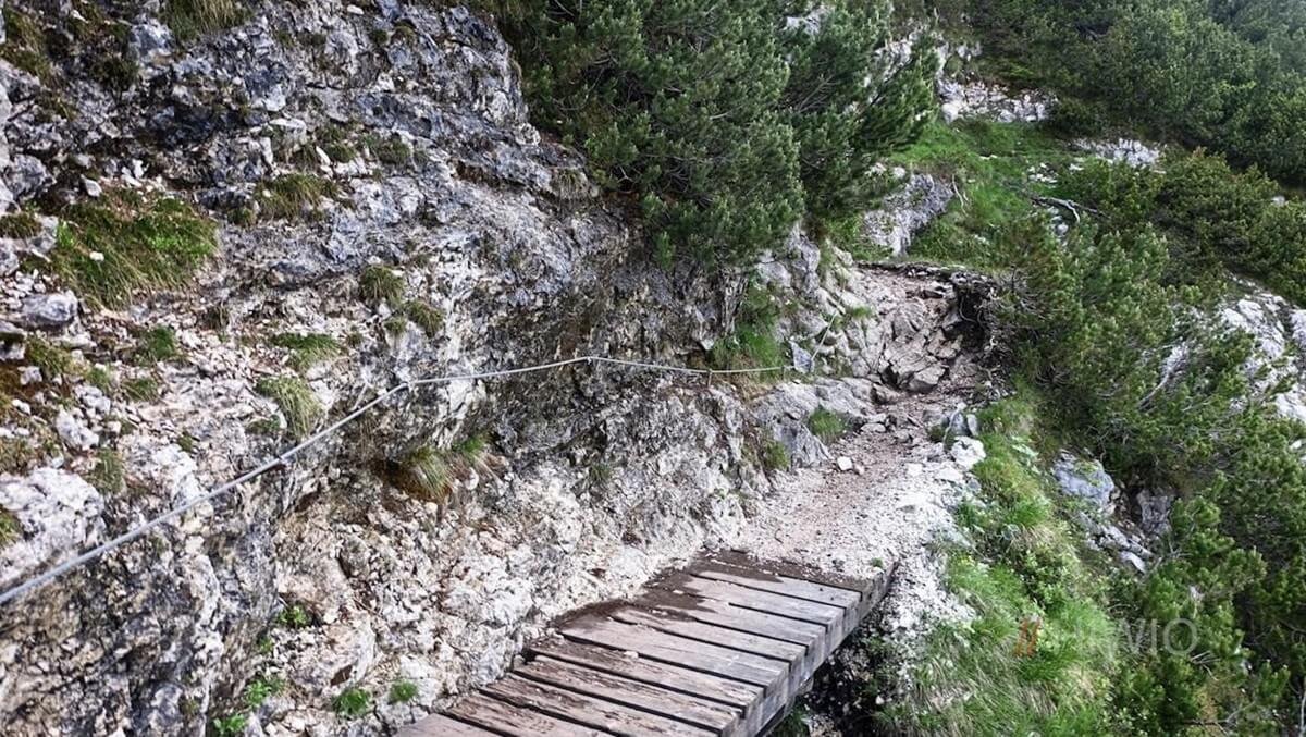
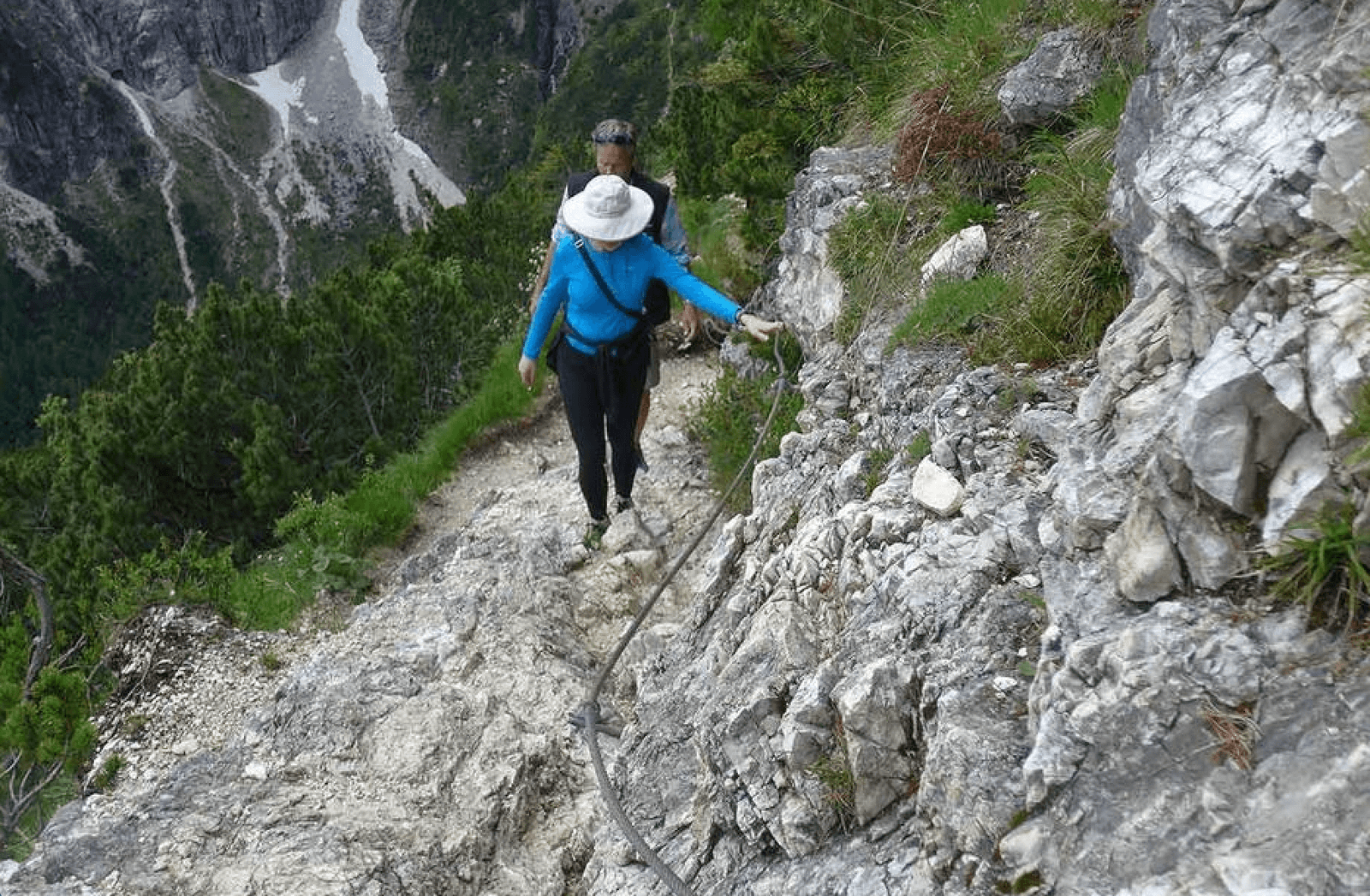
The most difficult places are the sections along the cliffs. Here the trail runs across a slope, in places with drop-offs, and is equipped with metal cables.
In the final part, the trail comes out at the lake, and a view opens up of the bright turquoise water and the mountain cirque around it.
Difficulty and safety
The route is considered moderately difficult, but there are points that are important to keep in mind.
Narrow sections
On some stretches the trail narrows to roughly the width of one person — about 50–80 cm. In such places you need to walk carefully, but you do not have to move sideways — the trail is comfortable enough to pass.
Sections with cables
There are several sections, usually 3–5, where metal cables are installed.
- each is 5 to 20 meters long
- the cables help you keep your balance on narrow and sloping spots
- no special equipment is required
Trail surface
The route is not rocky the whole way.
- at the start — forest and soft trail
- further on — rocks and rocky sections
- after rain the rocks can be slippery
Who the route is not suitable for
- people with a strong fear of heights
- those who are unsure about their physical fitness
- small children without experience
How high the trail runs
On the sections with drop-offs, the height difference can be tens of meters, and sometimes more than 100 meters down the slope.
The trail does not run along a vertical wall, but the sense of height is definitely there.
How to get there
The start of the route is at Tre Croci Pass.
By car
- about 15 minutes from Cortina d’Ampezzo
- parking is along the road
Parking:
- unofficial, along the highway
- capacity of roughly 30–50 cars
- in high season it fills up by 8–9 a.m.
By bus
In summer, roughly from mid-June to the end of September, buses run from Cortina d’Ampezzo.
- first bus — around 6:00–7:00 a.m.
- after that every 30–60 minutes
- the last return service — around 18:00–19:00
The fare is about 3–5 euros one way. You can check the current timetable on the official Dolomiti Bus website: www.dolomitibus.it.
Route map
This is the classic route to Lake Sorapis along Trail 215 from Tre Croci Pass.
You can view and download the route map here: Lago di Sorapis Trail on AllTrails.
It is also convenient to use:
- Komoot
- Google Maps, searching for “Lago di Sorapis trail 215”
When it is best to go
The best season for the hike: June through October.
Why this period in particular:
- the trail is free of snow
- comfortable temperatures
- mountain huts are open
By month
- June — snow is possible on some sections
- July–September — the best period
- October — fewer people, but colder
Best time of day
- start: 6:00–8:00 a.m. — optimal
- alternatively: around 15:00–16:00
If you go in the afternoon, you need to plan your time so that you get back before dark.
Doing the route in the dark is not recommended because of the narrow and dangerous sections.
Why the lake is so blue
The color of the water in Lago di Sorapis comes from glacial dust, that is, fine rock particles that scatter sunlight and create the characteristic milky-turquoise shade. The effect is intensified by light reflecting off the surrounding pale rocks.
Rifugio Vandelli
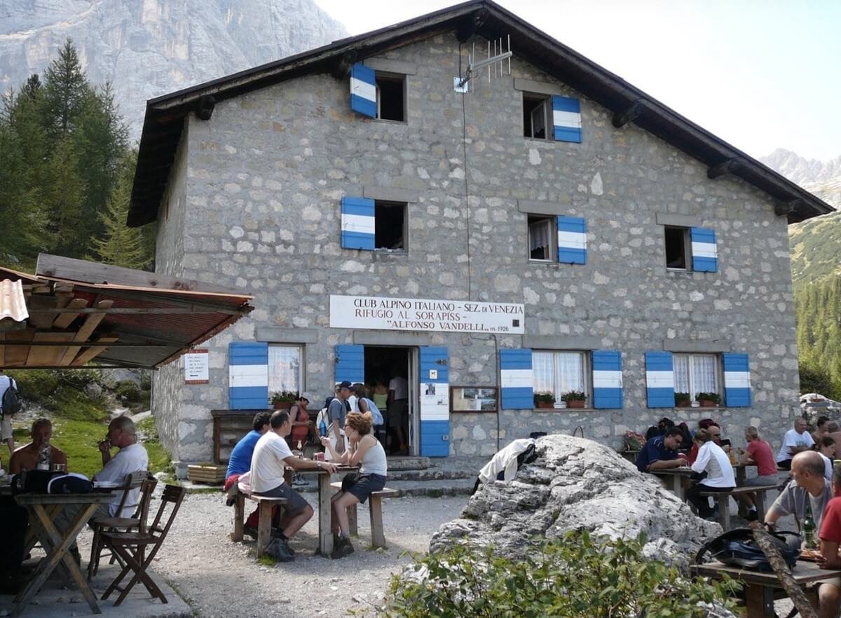
Next to the lake is the mountain hut Rifugio Vandelli — a classic alpine house.
What it is:
- a wooden building in the mountains
- inside — tables, benches, simple rooms
Here you can:
- eat simple dishes: pasta, soups, sandwiches, desserts
- have coffee or tea
- sit on the terrace with a view of the mountains
There are also places to stay overnight by advance reservation.
This is a convenient place to rest after the climb.
What to see nearby
- Lago di Braies — the most photogenic lake in the Dolomites, with wooden boats and mountain reflections
- Val Gardena — one of the best-known regions of the Dolomites for relaxation, hiking, and beautiful alpine panoramas
- Alta Badia — a picturesque region of the Dolomites with beautiful villages, panoramas, and well-developed infrastructure
- Sella Ronda — the most famous circular route in the Dolomites, which in winter is skied around the Sella massif
If you are only just planning a trip to the region, it is also useful to look in advance at the general article on Dolomiti Superski to better understand the geography of the region.
Useful tips
- Wear comfortable trekking shoes.
- Take enough water.
- Set off early in the morning.
- Check the weather forecast.
- Walk carefully on the narrow sections.
Swimming in the lake is not recommended, in order to preserve its unique ecosystem.
FAQ
How long does it take to walk to Lake Sorapis?
On average 2–3 hours one way.
How difficult is the route?
A moderate level of difficulty; there are narrow sections and cables.
Can you go with children?
Yes, but only with older children and with good preparation.
Where do you park?
At Tre Croci Pass, along the road.
When is the best time to go?
July through September, and early in the morning.
Can you swim?
Not recommended.

Konstantin is an acclaimed travel writer, celebrated for transforming ordinary journeys into extraordinary narratives. With years of experience exploring diverse destinations across the globe, his work blends vivid storytelling, cultural insights, and practical advice to inspire wanderlust and guide readers toward unforgettable adventures.
As a key contributor to enjoythetrip.org website, Konstantin has built a loyal readership through their expertise in uncovering both iconic landmarks and off-the-beaten-path treasures. He specializes in providing travelers with honest, actionable tips, whether it’s finding the best resorts in Maldives, exploring cultural hubs like Paris, or diving into the natural wonders of Croatia.