
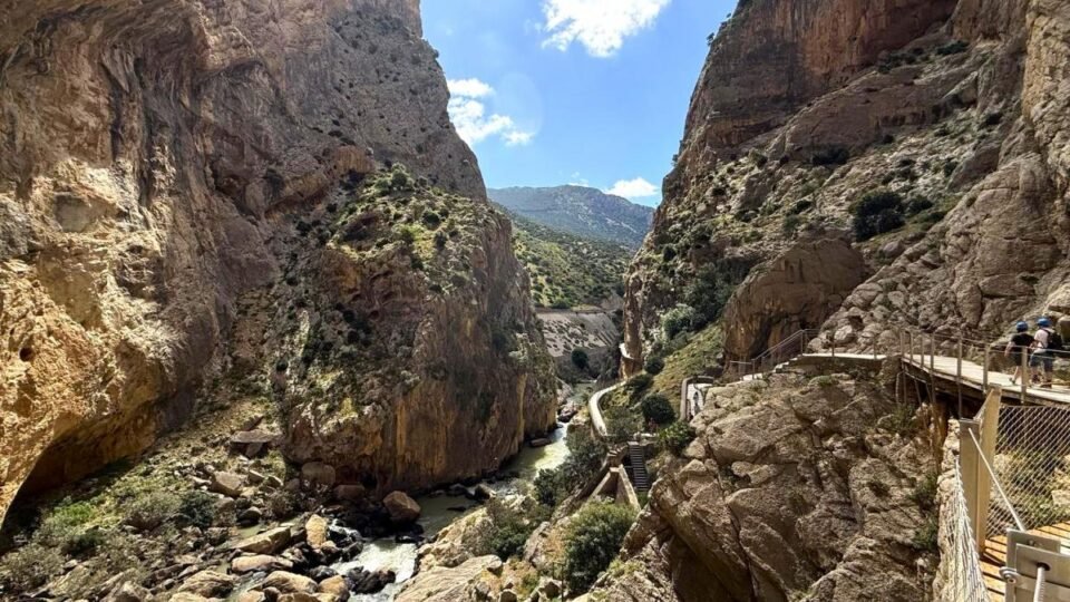
The King’s Path, or Caminito del Rey (El Caminito del Rey), is a unique walking route in the El Chorro gorge, in the province of Málaga in Spain. It is a suspended footpath laid almost 100 metres above the ground along sheer cliffs, with nothing below but a drop, boulders and a turbulent mountain river.
Spain attracts a huge number of tourists from all over the world every year, which has already led to large-scale protests by local residents and numerous restrictive measures.
Even so, Spain also has plenty of lesser-known places that can impress even experienced travellers. And there, by contrast, visitors are welcome.
The history of Caminito del Rey
Once, only shepherds and hunters walked through the narrow gorge among the Andalusian cliffs. Here, between sheer walls of stone, a river roared, and the area itself seemed almost inaccessible to people. But at the end of the nineteenth century everything changed. Spain was developing rapidly, industry needed new routes and sources of energy, and the mountains could no longer remain an obstacle.
First, a railway was laid through the gorge between the cities of Córdoba and Málaga. For that time it was a genuine engineering marvel: tunnels were cut straight through the rock, and viaducts were built over the chasms. Trains began running here as early as 1865, opening a route for the transport of ore and coal.
But it soon became clear that the future did not belong to coal alone. The Spanish engineer Rafael Benjumea proposed using water as an alternative source of energy. His project was bold even by today’s standards: part of the river was diverted through an artificial canal through the mountains, and the water then plunged from a height of a hundred metres, driving a hydroelectric power station.
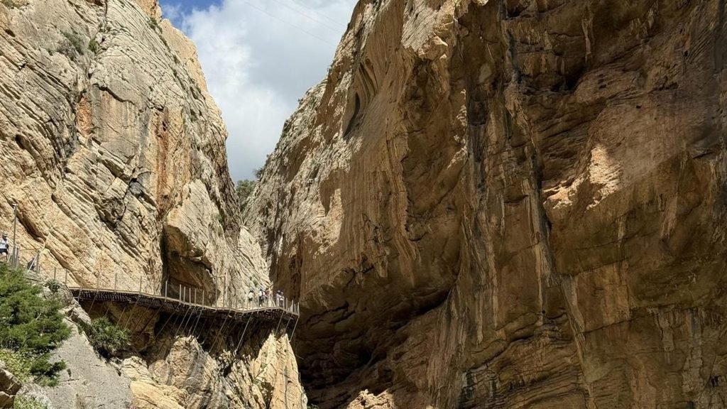
There was one problem, however: reaching the construction site was almost impossible. Workers had to move along narrow ledges above the drop, carrying tools and materials quite literally over an abyss. That was when the idea was born of creating a special path attached directly to the vertical cliff. This is how the “Balconcillos” appeared — narrow concrete walkways that seemed to hang in the air.
Later, dams began to be built nearby to supply water to the surrounding valleys in dry years. And in 1921 the King of Spain himself, Alfonso XIII, arrived to inaugurate one of the dams. He walked along that same dangerous path above the gorge — and after that the route received a new name: Caminito del Rey, or the King’s Path.
Over the years the wooden decking decayed, the concrete crumbled and the handrails disappeared. What had once been a service walkway for workers became one of the most dangerous trails in the world. Despite bans, adrenaline seekers still came. They clung to safety cables, crossed the drop without protection and filmed their risky exploits. Those images later spread across the internet and made Caminito del Rey a legendary spot among extreme sports enthusiasts.
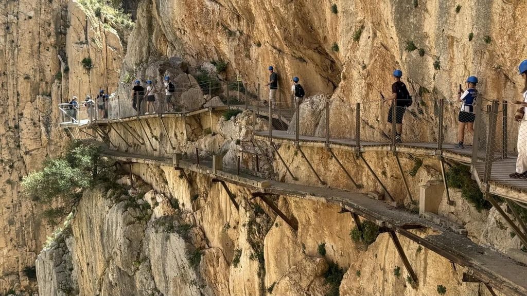
In 2000 the route was officially closed because of numerous accidents. It seemed the story of the path was over. But the Andalusian authorities decided to give it a second life. After a major reconstruction that cost millions of euros, new, safe walkways appeared above the old concrete remains.
In 2015 the King’s Path was reopened to tourists. Today it is no longer a terrifying route for extreme sports enthusiasts, but one of Spain’s best-known natural attractions. Even now, walking along the narrow paths above the gorge, it is easy to imagine how, more than a hundred years ago, amid the wind, the cliffs and the roar of the water, workers were quite literally building a road in the sky.
Features of the King’s Path
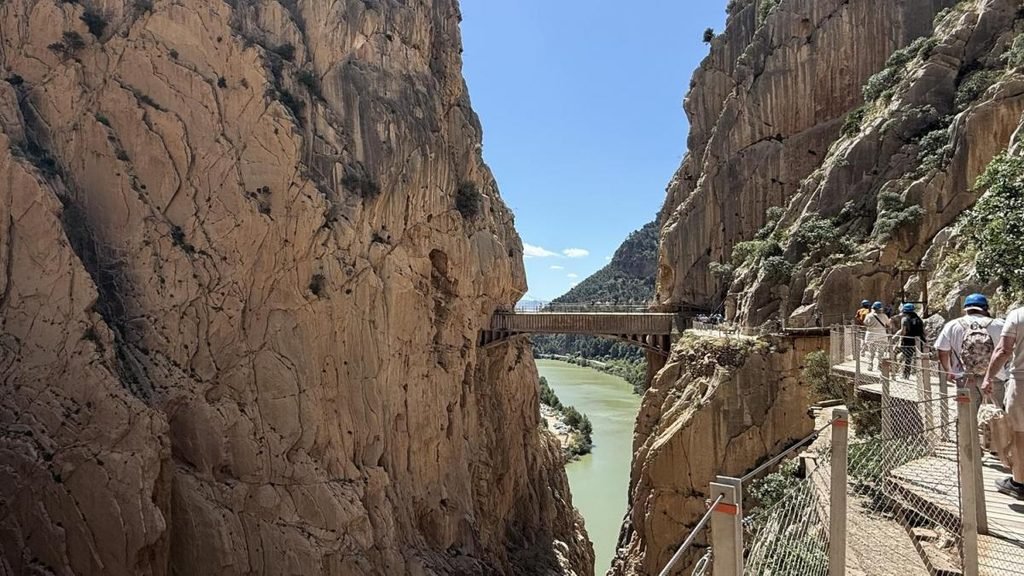
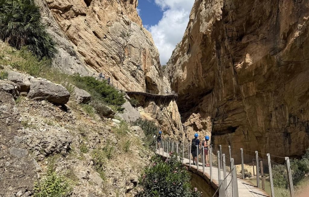
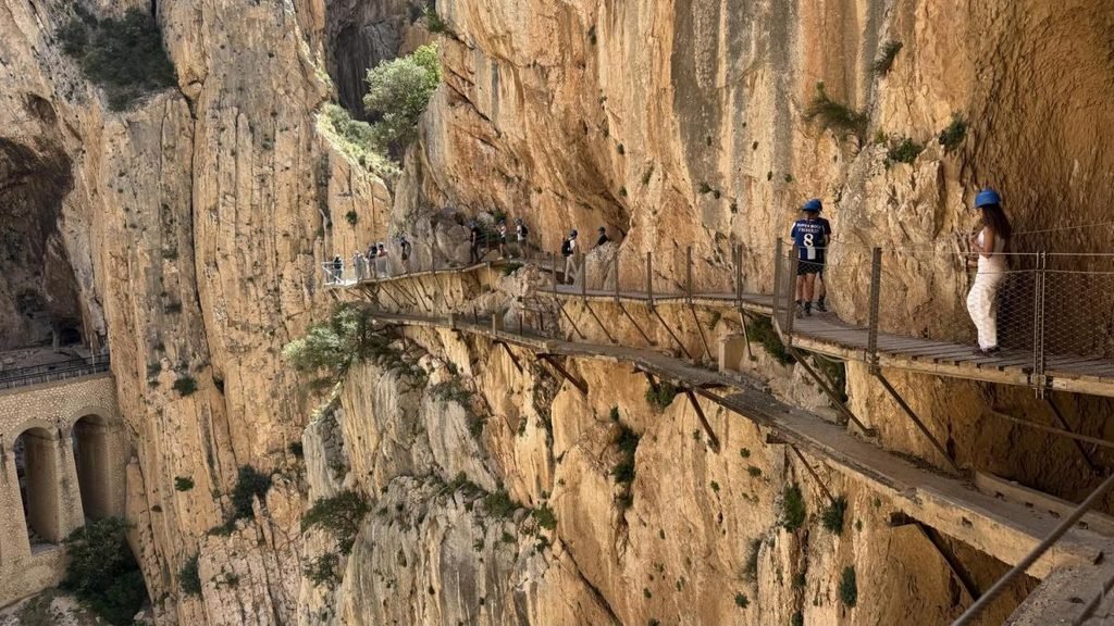
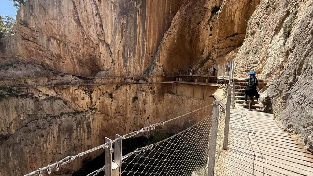
Today the King’s Path is a structure of concrete, metal fixings driven into the rock, and wooden boards. It is specially fenced and attached to the vertical stone walls, and every step here brings a mixture of delight and a slight rush of adrenaline. The path cuts literally into the sheer cliffs and runs at a height of about a hundred metres above the mountain river known as the Guadalhorce.
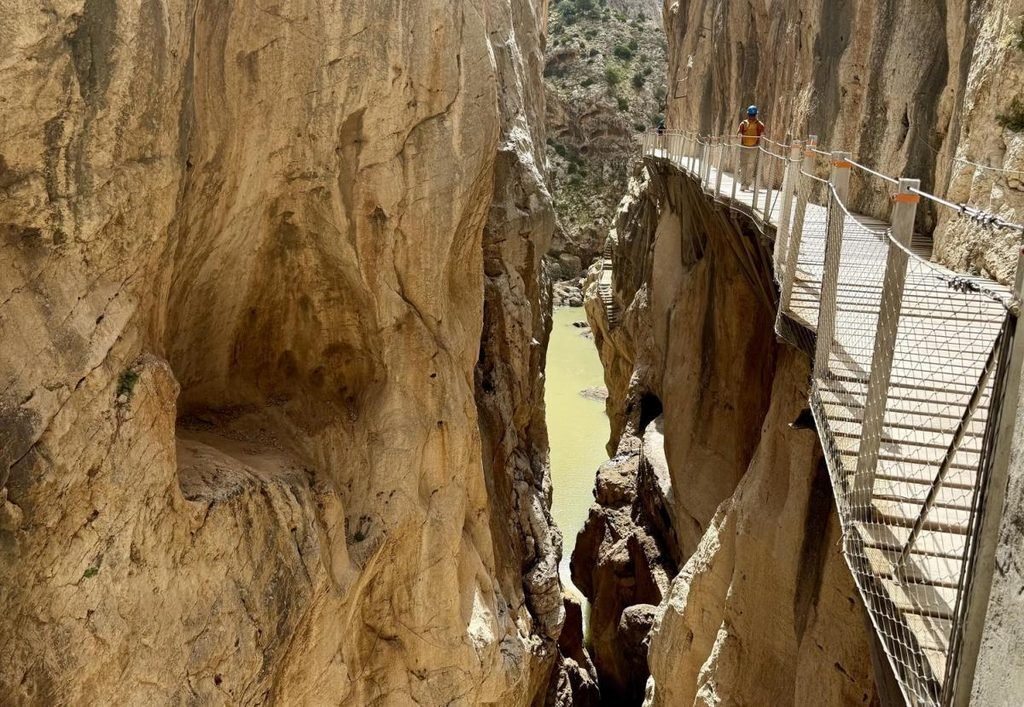
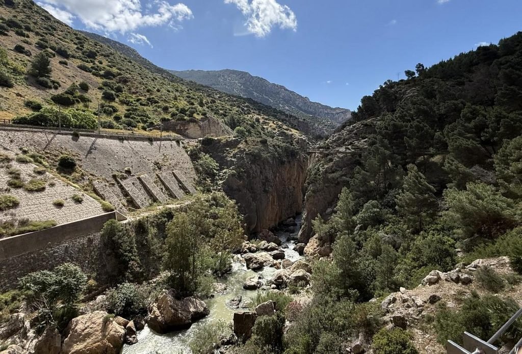
Caminito del Rey is almost 8 kilometres long, and along the entire way there are gorges, canyons, a river of vivid green water, the unique flora and fauna of the Spanish mountains, and picturesque valleys. The cliffs along the path were formed hundreds of millions of years ago by the tectonic uplift of the mountains and the subsequent erosion caused by the river. These distinctive vertical cliffs attract not only adventure and climbing enthusiasts, but also scientists, because ancient fossils can be found in the limestone deposits.
Tourists come here to see the impressive cliff landscapes with their own eyes, to examine them up close, and to experience the extraordinary sensation of moving above a drop of more than a hundred metres.
What impresses visitors even more are the remains of the old concrete path, narrower than the present one, which in some places breaks off above the drops and in others runs in parallel beneath the new walkway. It is hard to imagine how the builders once moved along such narrow passages…
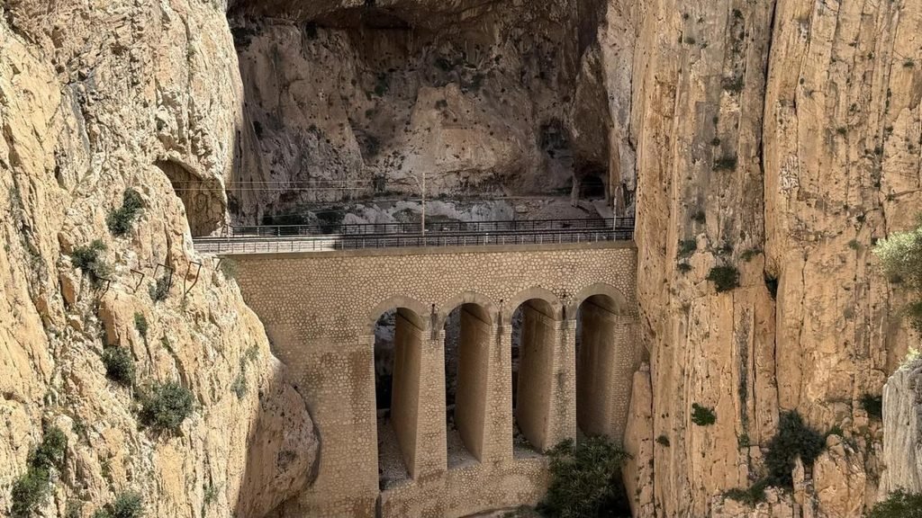
The route can loosely be divided into two parts: about 4.8 km are suspended wooden walkways, and the rest are forest trails. If the first part amazes with its cliffs and the ingenuity of its engineering, the second, riverside part delights the eye with nature: rare flora and fauna can be seen here. Wild mountain goats often appear on the cliffs, and high in the sky eagles and peregrine falcons that nest in the gorge circle overhead. In clear weather the birds of prey soar right above the river, riding the currents of warm air. Sometimes they come down so low that it seems you only have to reach out a hand to touch their wings, whose span is impressive — up to two metres. At least, that is what the guides say.
The time needed to walk Caminito del Rey usually does not exceed three to four hours. The route follows a forest road along the river and gradually climbs, turning into a path along the cliff. It is worth remembering that you will not be allowed to walk as slowly as you like and enjoy nature for as long as you wish. Guides assigned to each group keep a close watch to make sure no one gets lost or falls behind, because after the first group comes the next, under another accompanying guide, and so on.
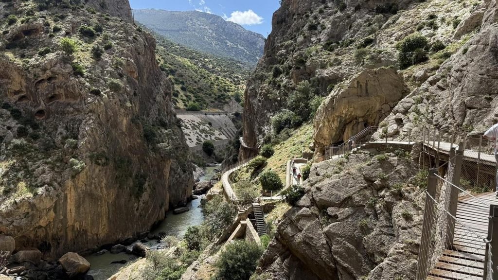
During the walk, guides often show tourists the marks on the cliffs that indicate how high the river rises in times of flood. A small mountain stream that in some years (before the dam was built) even dried up completely could, during a flood, rise as high as 27 metres in the gorge (that record was recorded). And as for drying up — that is no joke, because in this part of Spain the number of sunny days in a year exceeds 300.
How to get to the King’s Path
To visit one of the most beautiful mountain trails in the world, you first need to fly to Málaga. Flights to this Spanish city operate on a regular basis from many European capitals and even from smaller towns. The cost of the flight depends on how far in advance the ticket is bought, whether you have checked baggage (add 50 euros straight away), and whether you pay for priority boarding.
There are several ways to get from Málaga to the King’s Path. The most popular option is by car: the journey takes about 1–1.5 hours depending on traffic. The route follows picturesque Andalusian roads through small towns and mountain landscapes. You need to head towards Ardales or El Chorro. Several car parks have been provided near Caminito del Rey, but in the tourist season they fill up quickly, so it is better to arrive early.
You can also reach the path in 40–50 minutes by train. Regional trains run from Málaga’s central station, María Zambrano, to El Chorro station, from where you can walk to the entrance of the path or take a shuttle (which may cost a few euros).
Another option is organised excursions from Málaga. Many tourist companies offer one-day tours with a transfer, a guide and tickets for the route already included. This is convenient for those who do not want to plan the logistics themselves or worry about parking and connections. You can also buy a ticket yourself on various tour operators’ websites.
It is important to remember that Caminito del Rey has a clearly defined route: the entrance and the exit are in different places. That is why special shuttles run constantly between them, taking tourists back to the starting point or the car park.
It is worth booking tickets in advance before you travel, especially in spring and autumn, because that is when the path is most popular with tourists. And do not be taken in by claims that you can buy tickets for ten euros right at the entrance: that is almost impossible, because tour operators buy up all the available slots and then resell them.
When to visit and what to bring
Caminito del Rey is closed to tourists from 28 October to 25 March, so a trip should be planned with this period in mind.
The route runs from north to south and begins next to a picturesque reservoir. The start of the route is at the Hotel La Garganta, so if you have come by car you first need to go into the hotel itself and check in at the reception desk. There each tourist is given water and a wristband. At the entrance to the hotel you should wait for the guide, who will take a roll-call of those who have registered. From here a shuttle bus will take you to the start of the route. If you are travelling as part of an organised group, the guide leads the route.
All tour operators and guides strongly recommend bringing, above all, comfortable sports shoes for the path (trekking boots are not essential, since there are no difficult obstacles along the way, but tourists are advised to wear trainers or something similar with a closed toe), a cap or hat for the sun, and comfortable clothing. In spring, in May in particular, the air temperature among the cliffs can be so high that tourists walk in light T-shirts. In the summer months, however, visiting the path without covering clothing and sun protection is strongly not recommended — you can get sunburned very quickly.
Be sure to take a sufficient supply of water with you, at least 1.5 litres per person (in summer you can take more), as well as snacks.
In addition, guides recommend bringing a passport or ID card, and an ID card for children as well. Elderly tourists should have the original of their identity document with them. And it should not be forgotten that children under 8 are not allowed on the path.
Although the route is well secured and it is almost impossible to fall, the rules here are extremely strict: every tourist must wear a protective helmet — without one, going out onto the path is strictly forbidden.
Guides keep a close watch on compliance with the rules. During our trip one of the tourists decided to take off her helmet for a few seconds to have her photograph taken against the landscape. This was instantly noticed both by the guide and by the security staff who are on duty along the entire route. The young woman was given a stern warning and made to delete the photo — even from the “Recently Deleted” folder. Safety is taken very seriously here, so that no one tries to repeat dangerous actions for the sake of a striking shot.
This area also has its own grim story, which the guides are happy to retell. In the surrounding forests grows a rare tree that, when it burns, gives off extremely toxic smoke. Several years ago, because of intense heat, a major fire broke out here. Firefighters who arrived to put it out began to lose consciousness, and some even died. Only later did scientists establish that the cause was the poisonous smoke from this plant. That is why strict fire-safety rules apply along the entire route. Tourists are strictly forbidden to smoke, not only ordinary cigarettes but even electronic ones. It is not permitted to light a fire or to use any objects that could cause a blaze. In this place nature amazes with its beauty, but at the same time it is a reminder of how dangerous it can be.
Tips from personal experience
If you manage to book a time to visit the path first thing in the morning, for example from 9 a.m., that does not mean you will set off at that exact hour — you will most likely have to wait for a group to assemble (if you are travelling on your own), and only then, together with the guide, will you go to the bus and then on to the path. Sometimes you have to wait 15 minutes for the group to gather, and sometimes as long as an hour. The main thing is that if you have a paid ticket, you will definitely get onto the path.
Before the start of the route you will necessarily have to put on a protective helmet. For hygiene reasons you will be given a disposable cap, but these do not let air through and your head sweats terribly underneath. So it is better to replace that cap with your own baseball cap or a hat made of natural materials.
Since the trip takes only three to four hours, or even five in all, you can count on being free by lunchtime if you decide to set out on the path in the morning. In that case, if you have a hire car or your own, you might consider a trip to the exceptionally beautiful town not far from the path — Ronda. It is famous for being built on the cliffs, with the two parts of the settlement joined by a very high bridge.
***
Spain is a very diverse country, so you should not concentrate only on a few of the best-known places, such as Barcelona or Madrid: there is still a great deal else of interest there.

Konstantin is an acclaimed travel writer, celebrated for transforming ordinary journeys into extraordinary narratives. With years of experience exploring diverse destinations across the globe, his work blends vivid storytelling, cultural insights, and practical advice to inspire wanderlust and guide readers toward unforgettable adventures.
As a key contributor to enjoythetrip.org website, Konstantin has built a loyal readership through their expertise in uncovering both iconic landmarks and off-the-beaten-path treasures. He specializes in providing travelers with honest, actionable tips, whether it’s finding the best resorts in Maldives, exploring cultural hubs like Paris, or diving into the natural wonders of Croatia.